You know, in the ever-changing world of geospatial tech, Gsss Gps Rtk has really become a go-to for precise surveying and mapping work. If you look at a report from MarketsandMarkets, they’re projecting the global GNSS (that’s Global Navigation Satellite System, by the way) market to hit around $134 billion by 2026. And a big chunk of that growth is fueled by RTK solutions, which are pretty much revolutionizing how accurate we can get. One company that's making waves in this space is Shanghai Apekstool, also known as APEKS. They’re based in Shanghai, China, and are really pushing the envelope with innovative products and custom solutions tuned to meet the rising demands of modern surveying.
But, real talk—adopting Gsss GPS RTK isn’t all smooth sailing. There are definitely some hurdles, like tricky signal reliability, the high costs of equipment, and the need for skilled professionals who know their way around this tech. In this blog, I’ll break down these challenges and share some tips to help you navigate the complexities of using Gsss GPS RTK in your projects. Let’s get into it!
Understanding Gsss Gps Rtk: An Overview of Current Applications and Limitations
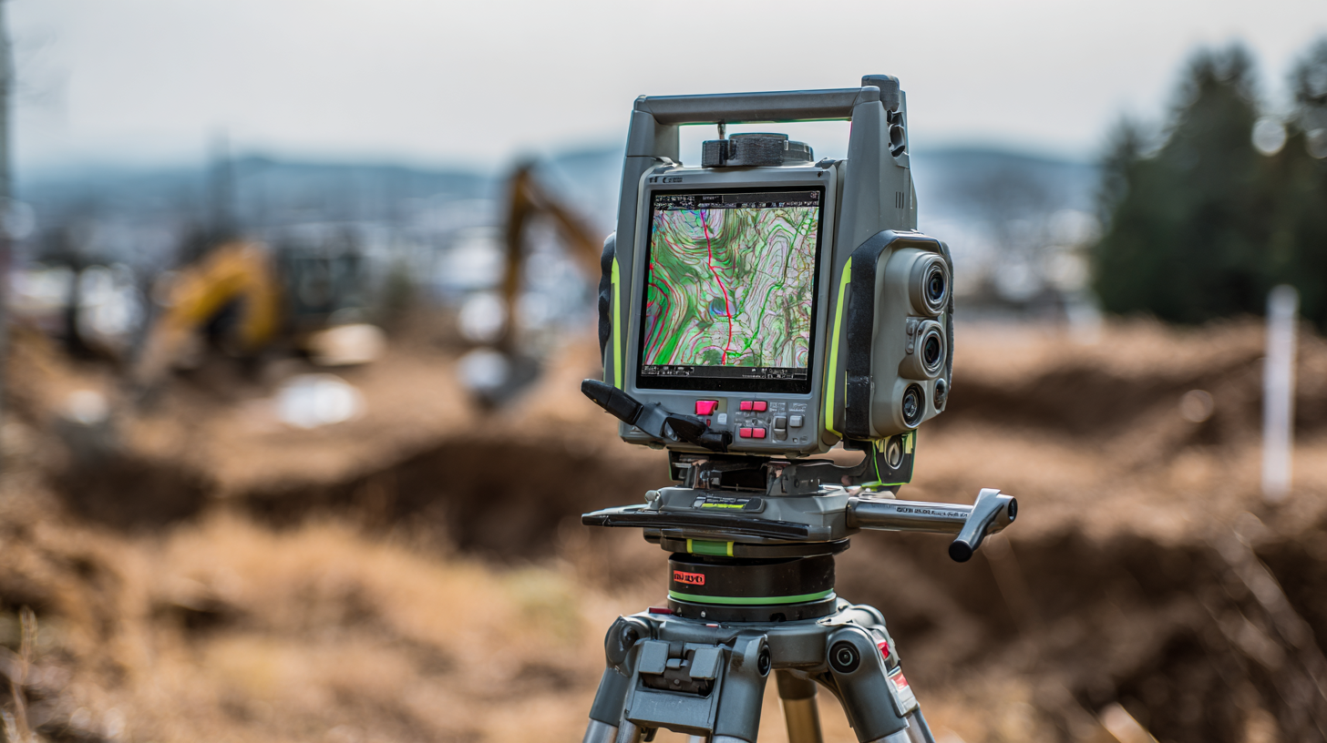
The Global Satellite Navigation System (GNSS) with Real-Time Kinematic (RTK) tech has really become a go-to tool nowadays for all sorts of stuff—from farming to driverless cars. What makes it stand out? Well, it can pinpoint your location down to just centimeters, which is a game-changer for industries that really need that kind of precision. Take farmers, for example—they use Gnss Rtk to make sure they plant seeds at the right depth and spread fertilizer evenly. And surveyors? They rely on it to get super accurate measurements, which is crucial when planning cities or constructing buildings.
Of course, it’s not all perfect. There are some hurdles, like needing a clear view of the sky to pick up satellite signals. In busy city areas with tall buildings, that can be a real problem because signals get blocked or weakened. Plus, setting up RTK systems isn’t cheap—things like base stations and supporting gear can add up quickly, making it hard for smaller operators to get on board. Things like atmospheric conditions or signals bouncing off surfaces (those multipath errors we're always talking about) can also mess with accuracy. Researchers are working hard to fix these issues, but it’s important to understand both what makes GNSS RTK awesome and where it struggles so we can see how it might be used more widely in the future.
Evaluating Accuracy: Comparing Gsss Gps Rtk to Alternative Positioning Technologies
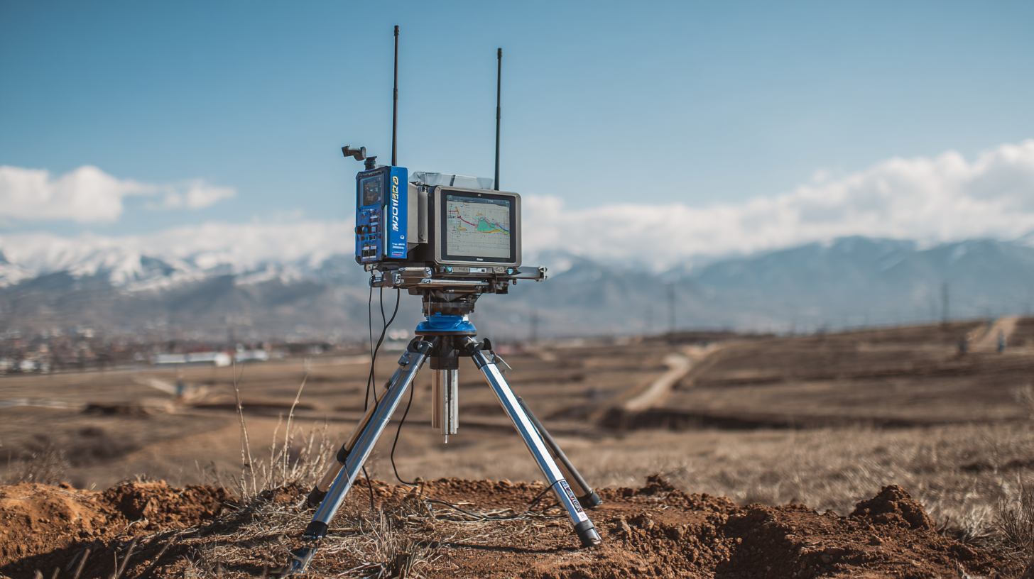
Lately, there's been a big jump in how much people need super Precise Positioning across lots of different fields. This shift has helped push forward technologies like GSaaS GPS RTK (that's Real-Time Kinematic systems). These systems are pretty amazing—they can usually pinpoint locations with just centimeters of error in real-world stuff like farming, land surveying, or even driving autonomous vehicles. But, of course, there are still some hiccups when you compare GSaaS GPS RTK to other positioning options out there.
When you're trying to figure out which system is best, it really helps to look at what each one does well—or not so well. For example, traditional GPS might not be that accurate, often measuring errors in meters, which makes it not so great for really detailed work. Meanwhile, other tech like GNSS (that's Global Navigation Satellite Systems) and fancy inertial navigation systems are always getting better. They can sometimes give similar accuracy—but usually need extra gear or more complicated calculations to match what GSaaS GPS RTK can do in real-time.
Ultimately, the best pick depends on what you need it for. Keep in mind, GSaaS GPS RTK depends heavily on having a solid communication link, which can be a pain in really remote areas. Other options might actually work better in tough environments. So, it’s all about weighing the pros and cons to get the most out of these systems for whatever you're working on. Staying on top of how these tech options perform is key to making sure you're getting the best results, no matter the situation.
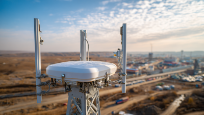
Impact of Environmental Factors on Gsss Gps Rtk Performance in Urban Areas
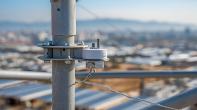
When you're working in urban environments, you’ll notice that GSSS GPS RTK technology doesn’t always perform perfectly. Tall buildings, thick greenery, and other obstacles can mess with satellite signals, making the system less accurate and causing delays. This issue gets even trickier in cities with crazy architecture, where signals bounce off surfaces and create multipath errors—kind of like echoes that throw off your measurements.
Here’s a handy tip: if you're trying to get better results in these busy city areas, consider using ground-based augmentation systems alongside your satellite signals. These can really help cut through the urban clutter and give you a more reliable fix on positions.
Plus, don’t forget that weather plays a part too. Conditions like heavy rain or fog can mess with signal clarity due to atmospheric delays—think of it as the weather throwing a wrench in the works. So, it’s smart to understand these limits and tweak your setup based on the environment you're working in.
Another tip: doing a quick site survey before you start can be a game-changer. Identifying potential interference sources or obstacles early on allows you to plan smarter—maybe include some alternative solutions or adjustments—to keep everything running smoothly and ensure your GPS stays accurate.
Cost-Benefit Analysis of Implementing Gsss Gps Rtk Technology vs. Alternatives
In today's world of tech-driven applications, you’ve probably noticed that GSSS GPS RTK technology is really starting to catch on. Still, it’s important to weigh the pros and cons before jumping in. Sure, these RTK systems can deliver incredible accuracy—down to just centimeters—which is a game-changer for things like surveying, farming, or autonomous vehicles. But let’s be honest, they don’t come cheap. According to the International Journal of Precision Agriculture, setting up such a system, including gear and training, can run anywhere from 10,000 to 50,000 bucks depending on how big your operation is. That’s a lot more than traditional GPS, which might only give you meter-level accuracy at a fraction of the cost.
That said, in the long run, those benefits might totally outweigh the upfront costs. A study by the Precision Agriculture Society found that farms using RTK tech saw crop yields jump by about 15-20%. That’s pretty impressive, right? This is mostly because of better precision when planting and managing resources. When you’re crunching these numbers, it’s worth remembering that it’s not just about saving a few bucks on operational stuff—it's also about making smarter decisions and cutting down on resource waste over time. For big, high-value projects, the investment might totally be worth it. But if you’re running a smaller operation, traditional methods could still be your best bet for now.
Emerging Technologies: Innovations That Compete with Gsss Gps Rtk in Positioning Solutions
The world of positioning solutions is changing pretty quickly these days. Thanks to new tech, traditional GSSS GPS RTK systems are being pushed aside a bit. One of the hot topics right now is this whole new thing called Global Navigation Satellite Systems, or GNSS for short. These systems pull signals from multiple satellite networks at once, which helps make positioning more accurate and reliable — especially in cities where buildings and other obstacles can mess with satellite signals. It’s pretty cool to see how combining different sources really makes a difference.
On top of that, there’s been a real shift with Real-Time Kinematic — or RTK — tech, especially with more affordable, high-precision options popping up. These are changing the game for industries like farming, construction, and even autonomous vehicles. The best part? They focus on being user-friendly and affordable, opening up options for a lot more people compared to the old-school GSSS GPS RTK tech. With all these new solutions offering better performance and more features, companies really need to think about which tech actually fits their specific needs best—it's an exciting time out there!
Case Studies: Real-World Applications Showcasing Gsss Gps Rtk Challenges and Alternatives
 So, you know, implementing Gsss GPS RTK tech across different industries hasn't been all smooth sailing. There are quite a few hurdles that folks working with it often bump into. Take agriculture, for example—according to a report from the International Society for Precision Agriculture, nearly 40% of farmers faced connectivity issues that messed up how well their RTK systems worked. That’s a big deal because these glitches can seriously impact things like planting seeds and mapping yields, which in turn affects their productivity and profits. There are real stories out there where farmers had to settle for less accurate methods simply because their GNSS signals were spotty—really highlighting how much better infrastructure and tech need to get.
And it’s not just farming. Surveyors and builders are feeling the heat too. A survey by the American Society of Civil Engineers found that around 45% of professionals struggle to keep RTK accuracy in busy city environments—thanks, multipath signals, which tend to mess with the data. So, many engineers are now trying out other solutions, like combining GNSS with inertial navigation or setting up ground-based reference stations. These fixes can help with some of the problems traditional RTK faces, but they do come with their own set of challenges, meaning there’s still a lot of research and development to be done.
Long story short, while this tech is a game-changer in many ways, it’s clear that there's room for improvements all around—and the road ahead involves finding smarter ways to deal with these hurdles.
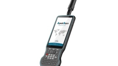
Maximize Your GIS and Survey Accuracy: The Impact of Apeks Stylus Pens in Android GNSS RTK Control
In the realm of Geographic Information Systems (GIS) and surveying, accuracy is paramount. Maximizing precision in data collection can significantly affect project outcomes, and this is where the Apeks Stylus Pens come into play, particularly in conjunction with advanced devices like the ones powered by the UM980 motherboard. Featuring a 2.0 GHz brand-new industrial processor and running on Android 10 with GMS AR Core, this combination ensures that operators can achieve unparalleled accuracy in their measurements.
The UM980's robust specifications, including a long-lasting 9000mAh battery, ensure that you can work through extended field sessions without interruptions. Coupled with 64GB of high-speed DDR4 memory and 4GB of RAM, the performance of these devices underlines the necessity of dependable tools like Apeks Stylus Pens, which enhance user interaction with GNSS RTK control systems. With a new design and integration of Corti Keyboard, it allows for seamless and efficient data entry, making the workflow smoother and more productive.
Incorporating these technologies enables surveyors to collect data efficiently and precisely, mitigating risks of errors that can arise from traditional methods. The synergy between high-performance hardware and advanced input tools like the Apeks Stylus Pens can revolutionize how GIS data is gathered and analyzed, leading to more accurate and reliable results in the field.
FAQS
: GNSS RTK technology is used for various applications including agriculture, where it helps optimize farming practices, and in surveying to enhance the reliability of measurements for urban planning and construction projects.
GNSS RTK provides centimeter-level accuracy in positioning, making it highly sought after in industries that require precision.
In urban environments, GNSS RTK can be impacted by tall buildings obstructing signals, leading to decreased accuracy and increased latency, as well as multipath errors from signal reflections.
Environmental factors such as atmospheric conditions (ionospheric and tropospheric delays) and weather variations like heavy rain or fog can impact signal clarity and reception, affecting GNSS RTK performance.
Practitioners can use additional ground-based augmentation systems alongside satellite signals to mitigate urban obstructions and enhance positioning accuracy.
Conducting a site survey to identify potential sources of interference and obstacles can help optimize the deployment and ensure reliable performance of GPS RTK technology.
Conclusion
Hey, I recently read this really interesting blog called "Understanding the Challenges with GSSS GPS RTK Technology in Modern Applications." It dives into the many sides of GSSS GPS RTK — which, if you didn’t know, is pretty dang important when it comes to modern geospatial surveying. The article talks about where this tech is being used right now and, honestly, points out some pretty common limitations. One thing I found interesting is how the accuracy of GSSS GPS RTK stacks up against other positioning methods — it’s quite a ride. But it’s not all smooth sailing; environmental stuff, especially in busy city areas, really messes with the performance. That’s a real challenge when you’re trying to rely on it in the real world.
They also touch on whether it’s worth the cost, weighing the money you’d spend versus other options out there. Plus, emerging tech is making things even more competitive, offering alternatives to GSSS GPS RTK — which is pretty exciting to see. The blog even shares some case studies that show how this technology is actually used in real-life projects, highlighting what’s tricky and what to watch out for. As someone who’s into GPS and GNSS systems, I gotta say, Shanghai Apekstool (APEKS) really seems to stay ahead of the game. They’re constantly innovating to meet the ever-changing needs of surveyors — pretty cool stuff, honestly.